Wednesday, May 28, 2014

May 26, 2014 Big Spring/Sterling City, TX Supercell

We woke up in Brownfield, TX knowing we needed to jog a bit south to get the best chance of seeing storms that day.  Along the way we decided to stop in Lamesa, TX and grab a bite to eat as well as a Lamesa High School t-shirt since their mascot is a tornado.  After eating, we slid south to keep an eye on the towering cumulus.  Eventually things got rolling and a surface-based, high-precipitation supercell developed west of our location.  Unfortunately, the roads were not in the greatest condition and there were a lot of chasers on the storm.  So, we tried to stay out ahead of all the other chasers the best we could.  I was able to grab a few shots of this storm before it began to surge out on us.  Soon everyone, and there mamas, left that storm for the one off to the south.  The road networks were awful once again and we did the best we could to get close.  Staying ahead of the storm was the key, along with avoiding other local-yocals.  The second storm began to die just after it illustrated some great structure.  Overall, it did produce a quick weak tornado (hard to see and we were driving at the time).  The storms simply lacked something in the low levels to really go nuts.  Once leaving the storm we overnighted in Brady, TX.


 My trip route.  6 days. 3,000 miles.

Monday, May 26, 2014

May 25, 2014 Carlsbad/Hobbs, NM Supercell

Our day started in Odessa, TX where we were faced with a bit of a decision.  There seemed to be two potential targets, one to the south (Fort Stockton, TX) and north (Carlsbad, NM).  We initially thought that storms would start forming off of the Davis and Glass Mountains, so we decided to jog south towards Fort Stockton.  Once we arrived and glanced at the visible satellite we noticed that things really were struggling.  There was a storm way down there south of Fort Stockton, but it was dying.  So, we backtracked north to play in between the two targets for a bit.  We sat for hours in Eunice, NM underneath of the cumulus field and watched the main cu pulse up to 50 dBZ and then dissipate within 20 minutes.  Since we had a room booked in Brownfield, TX and decided to make a run at some great looking storms up just east of Roswell, NM.  However, we kept an eye on the storm going up west of Hobbs, NM.  After noticing it was throwing off a left-split we decided to make a play on it.  The closer we got the better it looked and ultimately found a great spot to sit and watch the storm produced amazing rotation.  The motion in this storm was nuts and the clear slot was in the strangest location.  It gave us a really unique perspective.  The best part is that we sat in one location for an hour watching the storm move right by us.  Every five minutes the storm would do something different.  She really gave us a great show!  It was a structure freaks dream.  After dark, we attempted to grab some lightning shots, but the storm really didn't produce much.  We headed to Brownfield, TX where we stayed overnight. 

Walker Ashley (chubasco.niu.edu) time lapse of the day


Saturday, May 24, 2014

May 23, 2014 Hope/Carlsbad, NM Supercells

We started the day in Trinidad, CO with an initial target of Roswell, NM.  Given it was a bit of a haul, we woke up early and got on the road.  Once we made it to Roswell, we really didn't know what to make of the situation.  There was a storm getting going towards extreme SE New Mexico, but that cell was about two hours away and everything looked kind of "mushy" with the weak shear our area.  We decided to stay patient and see if a few storms could get going off of the Sacramentos and  Benson Ridge.  Once we jogged west of Artesia, NM towards Hope, NM we got a decent look at the storm(s).  They looked sloppy at first and really multicellular in nature.  Remaining patient, we sat out there contemplating where to stay the night and whether or not we killed ANOTHER storm; however, things really started to get going at that point.  We busted south to get a closer look at the southern cell and it seemed to be pulsing.  The road network was really crap and we just had a gravel road east option.  It was full of Arroyos and really not meant four our Chevy Cruze.  After beating the car to hell (it's still in one piece, I think), we were able to stop a few times and grab some photos of cows and a nice looking supercell.  The storm consistently became better and better, ultimately pushing us to the main highway, where we got ourselves into a bit of a pickle.  The original supercell began to push its way north of us and a new classic supercell developed behind it.  The big issue was a left-split that was thrown off of a storm to our south.  It was screaming up right towards us.  The problem was that we really didn't have a great escape option (from hail) given we had a supercell to our south, north, and west (and no roads east).  Ultimately, we had to thread the needle by letting the big, hail producing, monster left-split pass just to our east and dropping south behind it as it merged with our old, dying, original supercell.  As we ran south we came across a nice hail streak with dime to nickle size hail and flash flooding.  We watched the convection, now merged together, move off as the sun came down and hail fog covered the ground.  Overall, it was a crap-shoot kind of day where we just found ourselves in the right location by remaining patient and trusting our instincts.  Ending up with three supercells (two classics (classic to low precipitation transition) and a left-split)), hail (not hitting us), hail fog, a decent lightning show, and cows makes for a good day.  I'll take high-based supercells over a messy tornado producing monster with storm chaser convergence ANY DAY OF THE WEEK.  Let's see if we can repeat today.

Walker Ashley's time lapse of the day


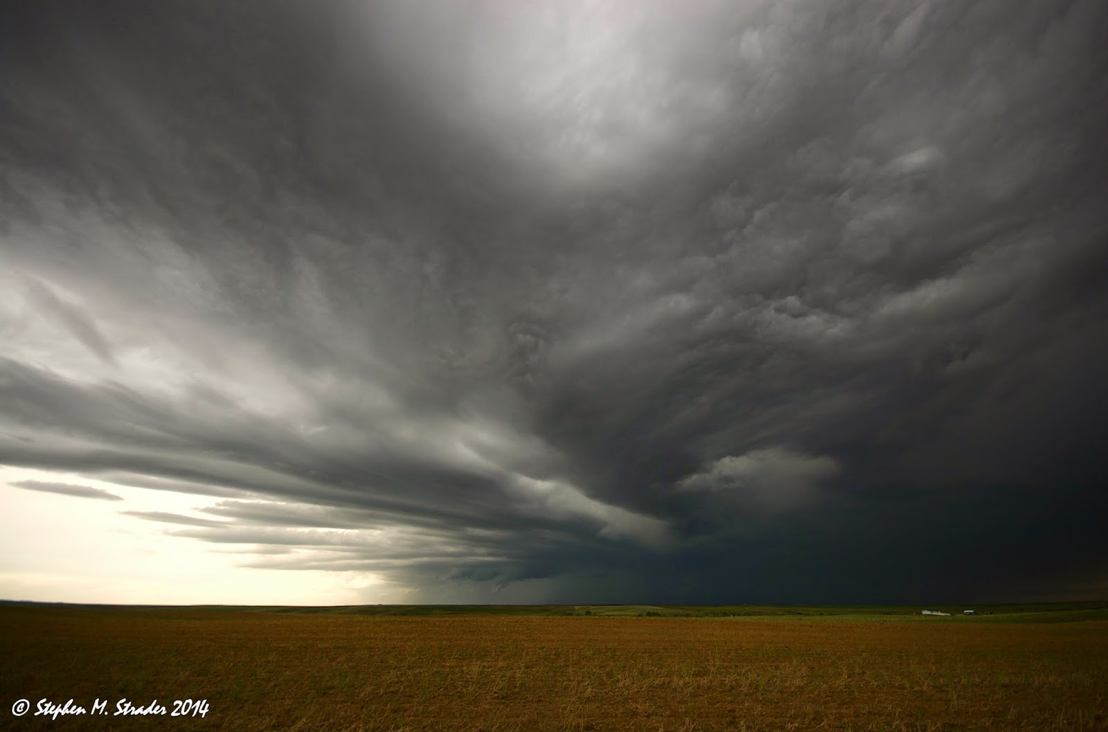
Original supercell starting to get naked and go LP.

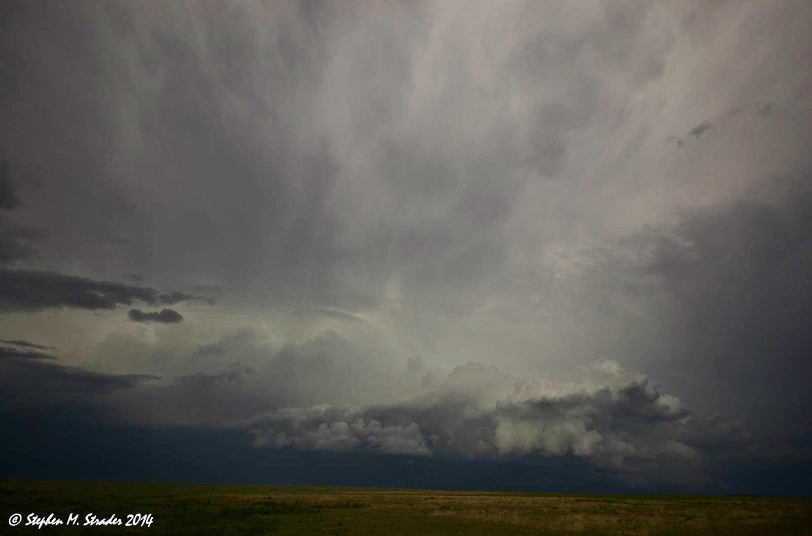
Second classic supercell really looking good.


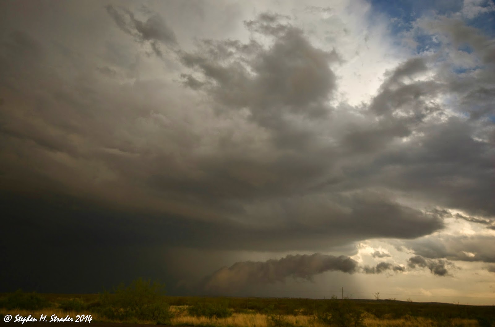
Uh oh.... here comes the left split.


After the merger.  Notice the hail fog caused by the hail dropped by the left-split.
Thanks Carlsbad!

Friday, May 23, 2014

May 22, 2014 Deer Trail/Byers, CO Multicell Storms

This day was a marginal day as far as severe thunderstorm potential goes.  The mid-level winds never really got going and the storms struggled to stay organized.  At times the storm we were on showed signs of getting its act together but never actually did.  The really cool stuff came later on in the our storm's life cycle when it began to develop some really cool inflow bands and illustrate some great elevated convection.  The best part about this day was getting to sit in the middle of Colorado wheat fields without any other people in sight.  It was a pretty darn good day despite sloppy storm modes.


Thursday, May 22, 2014

May 21, 2014 Byers, CO HP Supercell

Day one of my chase trip started early (left DeKalb at 3:20 AM) and ended in Denver, CO (1,000 plus miles later).  It was one of those days where the storms fired early and we were pleading with the weather gods to hold off producing a great storm.  Nevertheless, a storm fired over Denver International Airport and began to illustrate one of the biggest hooks I have ever seen.  At first, the storm didn't look like the rotation was that tight up but shortly thereafter it started wrapping up nicely.  We were still a bit too far out to see anything (tornado) the storm may have been producing.  It was also very evident that the storm was going to be a rain-wrapped monster from early on so, we ended up playing around for some structure shots.  A near miss with the RFD surge and chaser convergence hell pretty much ended our day.  We did get a nice treat on the way back to the hotel where we saw a huge hail streak on the rolling hills.  Our attempts to get there were cut short by the rain-soaked dirt roads.  Overall, it was a long chase day but well worth it.