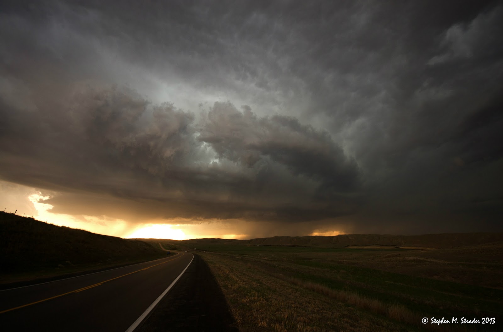
For the last few days Saturday and Sunday looked to be the big chase days with MDT risks being put out by the SPC well in advance. However, when we woke up in the morning on the 18th we realized that things weren't so cut and dry. The overall set up just looked to be very messy. There was a real lack of upper level wind speeds and the dry air mixing in from Western Texas really created some issues. We hit the road going south in hopes of hitting the bullseye in Southern Kansas. All of the models hinted at a big day down there with some long-lived supercells. But, we knew we had to be back in DeKalb by Sunday so we couldn't make it all the way down there. We decided to play the Northern Kansas target. We started off on a developing storm near McCook Kansas but soon began to realize that the storm to the East was becoming dominate. We decided to race ahead of it and intercept it as it moved northeast. The storm looked decent on radar, a bit sloppy, but still okay. We got on it and just as we anticipated it was 'chaser convergence'. Structure looked pretty good but it was very wet. Thought it was hard to see, there was a clear low-level meso present. As soon as we got on it, it began to surge out. We left the storm and thought about heading down south to the next storm (it was starting to look really good on radar and ultimately produced a nice cone tornado) but sadly we didn't have enough time. So, we actually were going to let the storm we were on pass us and get some lightning shots..... On the way back south we stopped to look at the amazing convection. It was going nuts! Bubbling, spinning, turning, etc. We glanced out of the window and saw a crazy funnel cloud out of no where (I was driving and couldn't grab a shot). It made zero sense. So, we pulled over and took some shots and noticed a few more funnel clouds. We had actually intercepted some type of strong wind shear boundary that was in the area and more than likely was the cause for the storm to the southwest being the storm of the day (producing amazing tornado). We sat there in the field snapping shots of little funnel eddies, spinners, bubblers, etc. as well as lightning. The winds came in and it got blustery. Then just in a matter of 5 seconds it got dead still.... No winds. No sound. Very cool stuff. So, even though we missed the storm of the day that produced a beautiful cone tornado, we got to see some amazing stuff. Different stuff. Enjoy.


 |
| Little horizontal funnel. Seen about 5 of these. |
 |
| Lightning hitting the sun. |