Tuesday, June 25, 2013

June 24, 2013 DeKalb, IL Derecho

This day was one of those days that had me licking my chops once I glanced at the radar.  Off to our west there was a bowing MCS moving approximately 70 mph and producing "hook appendages" (see radar) along the way.  I left Davis Hall early enough to have the option of heading to the parking deck on campus or possibly just west of town.  I flip-flopped on what the right call was and ultimately decided that heading west was the best option.  However, soon after I made it a few miles west of town I realized that this storm was hauling major ass (and my mobile radar stopped receiving updates).  Yet, it never produced a nice shelf cloud like I hoped for.  Within about 10 minutes the storm went from being off in the distance to on top of me.... This is the reason I don't like to mess around with MCS very much.  I had to race back east to get safely to shelter.  I didn't make it very far before rain curtains began surging in front of me moving sidways.  It was a gusty son of a gun and about blew me off the road.  Certainly white-knuckled driving.  Either way, the MCS produced a lot of wind reports as well as a few tornadoes.  Here is the NWS Romeoville office's write up on the event.  As I like to say, it was uneventful eventfulness.  Not the best photos but I took them and figured I would share.  Enjoy!


Sunday, June 23, 2013

June 23, 2013 DeKalb, IL Windfarm Convection

I glanced at the radar around 4PM and noticed a thin line of storms approaching DeKalb.  They didn't seem to be surging; thus, I was skeptical about the shelf cloud development out ahead.  Either way, I decided to jog out to the windfarm just south of town and take a chance. Alas, when I made it out to one of my favorite spots the thought that there wasn't going to be much of a shelf became a reality (and the flies were biting my ankles!!!).  However, what did result was some of my favorite shots of the year thus far.  The soybeans were in the ground and were represented by a vibrant green.  The haze let up and the sun shined just right on turbines.  The dark backdrop of convection was just beautiful too.  Sometimes (most of the time) you don't need a big honkin' severe storm to realize the beauty in the sky.  Overall, lots of lightning and lots of rain.  Enjoy!


Backside of the outflow looked better than the front

Friday, June 21, 2013

June 21, 2013 DeKalb, IL shelf

Not much to say other than this shelf came rolling over DeKalb in the afternoon.  Shelf season in the Midwest has begun.


Wednesday, June 12, 2013

June 12, 2013 Northern Illinois/Mt. Carroll tornado


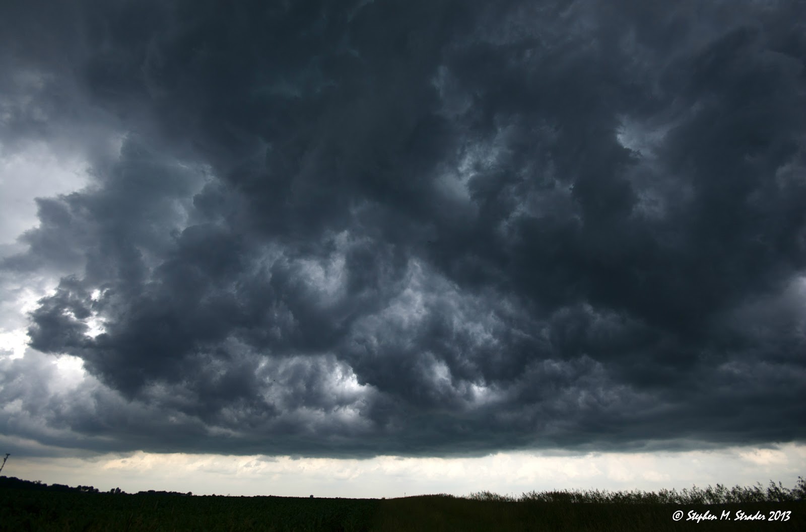
Today was a day filled with hopes.... sort of.... These high risk days in Illinois are known to bust and tend to leave people disappointed if they want to see some severe weather.  Anyway, we headed out from DeKalb around 1PM and headed for an early target near Freeport, IL.  We didn't quite make it but noticed that storms were starting to go up a bit early.  The boundary that developed was draped from Dubuque, IA to DeKalb, IL and was helping storms spin but... something was amiss.  Once storms crossed the boundary they became elevated and did all sorts of funky things.  Most of the storms went too early and really couldn't stay isolated.  The early storm motion was parallel to the low level winds and as a result were subject to crappy storm relative inflow....We let the early storms pass because they were merging/throwing off splits left and right....  We decided to wait around in Stockton, IL  and grab a bite to eat.  A storm sitting over Dubuque, IA was headed our way and really the only thing worth watching.  Though we all thought it looked awful on radar, the storm started to get it's act together.  So, we ended up messing around with it and when we got visual we noticed a dark lowering back in the storm.... Things became interesting at that point.  We were in pretty country but bad chase terrain with trees and hills.  We found high ground and watched the tornado bounce over the hills and trees.  Though the tornado really never got completely condensed down to the ground until late, it actually held ground circulation for quite a long time (10-15 min).  We soon ran out of road and tried getting back in front of it with hopes that it would cycle.... Once we moved about 10 miles SE we noticed that the air it was feeding on was quite cool and relatively dry compared to the air a few miles back.  The storm began to surge out/become elevated.  It did develop some interesting features like an orphaned horizontal funnel and a roll cloud though.  Illinois owed me one! Enjoy!

Victor Gensini's account of the day
Walker Ashley's account of the day
Matt Piechota's Video of the tornado

NWS survey results-
* LOCATION...THE TRACK BEGAN 6 MILES NORTH OF SAVANNA AND ENDED 4
   MILES WEST OF MOUNT CARROLL
* TIMING...FROM 6:53 TO 7:03 PM.
* INJURIES/FATALITIES...1 INJURY.
* EF-SCALE RATING...EF2.
* ESTIMATED MAX WIND SPEED...135 MPH.
* MAX WIDTH...ONE HALF MILE
* PATH LENGTH...APPROXIMATELY 6 MILES.
* DAMAGE INFORMATION...THE PATH OF THE TORNADO WAS WELL DEFINED WITH
   SIGNIFICANT TREE DAMAGE.  SEVERAL FARM OUT BUILDINGS WERE DAMAGED
   AND ONE HOUSE WAS PUSHED OFF ITS FOUNDATION.